
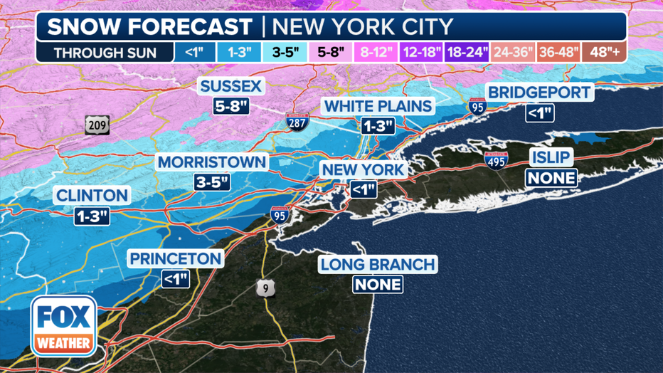
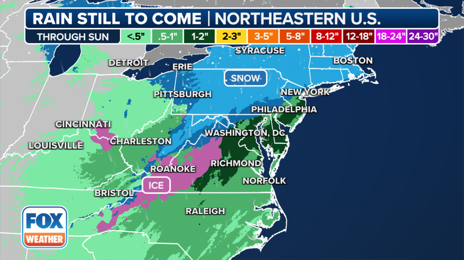
The year’s first significant winter storm in the east is bringing some significant snow to the northern and western suburbs, but New York City will miss out on any plowable snow.
After the initial “thump” of snow will transition to a wintry mix of snow and rain in the city and along in areas to the south and east.
There’s a chance for a light accumulation in the City on Sunday morning with wraparound snow behind the storm.
Snow will pile up into the overnight hours north and west of the city. Some higher elevations could pick up a foot or more.
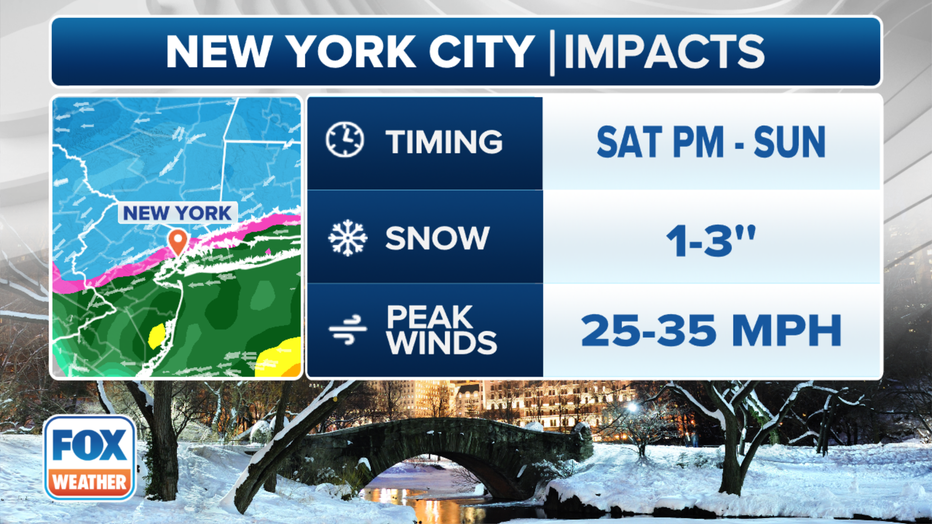
Manhattan
Main impact: Saturday afternoon through Sunday morning
Expect a mix of rain and snow.
Total snowfall: 1 to 2 inches
Winds: Gusts up to 30 mph
Brief minor coastal flooding is possible late Saturday night through Sunday morning.
Brooklyn
Main impact: Saturday afternoon through Sunday morning
Expect a mix of rain and snow.
Total snowfall: Less than an inch
Winds: Gusts up to 30 mph
Brief minor coastal flooding is possible late Saturday night through Sunday morning.
Queens
Main impact: Saturday afternoon through Sunday morning
Expect a mix of rain and snow.
Total snowfall: Up to an inch, with locally higher amounts to the northwest.
Winds: Gusts up to 30 mph
Brief minor coastal flooding is possible late Saturday night through Sunday morning.
Staten Island
Main impact: Saturday afternoon through Sunday morning
Expect a mix of rain and snow.
Total snowfall: Less than an inch
Winds: Gusts up to 30 mph
Brief minor coastal flooding is possible late Saturday night through Sunday morning.
Dutchess, Orange, Putnam and Ulster Counties:
Snow accumulations as high as 1 foot is expected in some parts of the Hudson Valley.
Rockland County:
The early snow accumulation was forecast in some areas at less than one inch. But the snow could become heavier tonight with a potential 3 to 5 inches before 1 a.m. Sunday. While snow could be heavy at times, there also will be rain mixed in as temperatures hit a low of only 30 degrees. The forecast calls for a chance of additional rain and snow early Sunday, then more snow. Temperatures could drop to 30 degrees by 5 p.m.
New Jersey
The heaviest snowfall is expected later Saturday evening with amounts nearing 1 inch per hour in Sussex County, which could see up to 12 inches of snow, according to the the National Weather Service.
Ocean County: 2 a.m. to 8 a.m. Sunday. Up to one half foot of inundation above ground level expected in low-lying areas near shorelines and tidal waterways.
The N.J. Department of Transportation issued commercial vehicle restrictions for several major highways that start at 2 p.m.
The snow is expected to wind down after 2 a.m. Sunday, though some light snow showers could linger into the morning.
(YWN World Headquarters – NYC)
 Join the official YWN WhatsApp status


One Response
I’m getting the sense they overpromised the snow. I’m in the 6-12 inches area and it’s barely a dusting so far.